Water Planning
Waiʻanae Plan FAQ
Here are commonly asked questions about the Waiʻanae Watershed Management Plan update project.
To view the responses, click or tap on the questions below, or download the FAQ as a PDF.
Where is the water that comes to the Waiʻanae Coast coming from?
Most of the drinking water that serves the Waiʻanae coast is coming from the Waipahu and Kunia area.
What percentage of water is coming into the West side from other regions of Oʻahu?
60% to 65% of water coming into the West side is from other regions of Oʻahu.
What spring feeds Kaupuni Stream?
The BWS’s Waianae Plantation Tunnel Number 3 discharges about 0.3 million gallons of water a day into the Kaupuni stream.
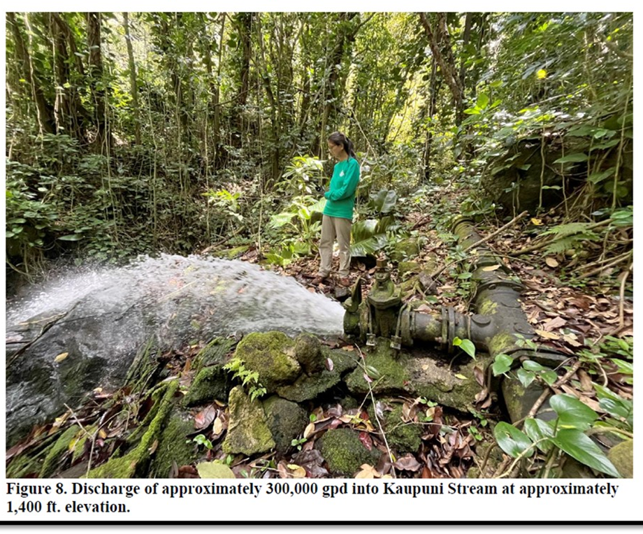
(Source: Waiʻanae Designation Petition)
What is the cause of recent observational decline of Kaupuni Stream flow?
According to the National Weather Service, Leeward areas of Oʻahu experienced a very dry winter, which has significantly lowered stream flows.
In 2022, the United States Geological Survey (USGS) installed a gauge on Kaupuni Stream makai of Kaʻala Farm, but it is not yet fully operational, and no flow data is available.
Is the BWS pumping from the spring that feeds Kaupuni Stream?
No, the BWS does not pump water from the spring that feeds the Kaupuni Stream.
How can the Waiʻanae Community participate with BWS on the Waiʻanae Watershed Management Plan Update?
The Waiʻanae community can participate by:
- Checking out the management plan website at: https://www.boardofwatersupply.com/water-resources/water-planning/watershed-management-plan/waianae-plan.
- Providing input using the online form: Waiʻanae Watershed Management Plan Update Community Input Form.
- Contacting Kathleen Pahinui, the BWS’s Public Information Officer, at (808) 748-5319 for more information on the Watershed Management Plan.
- Attending public meetings hosted by the BWS, where Barry Usagawa, who oversees the BWS’s Water Resource Division, often speaks and is available to answer questions.
Posted: 05/05/2025